Using Drones for 3D Roof Models
Roof 3D model As with all projects health and safety is a top priority. When it comes to surveys of structures especially a roof there are loads of protocols put …
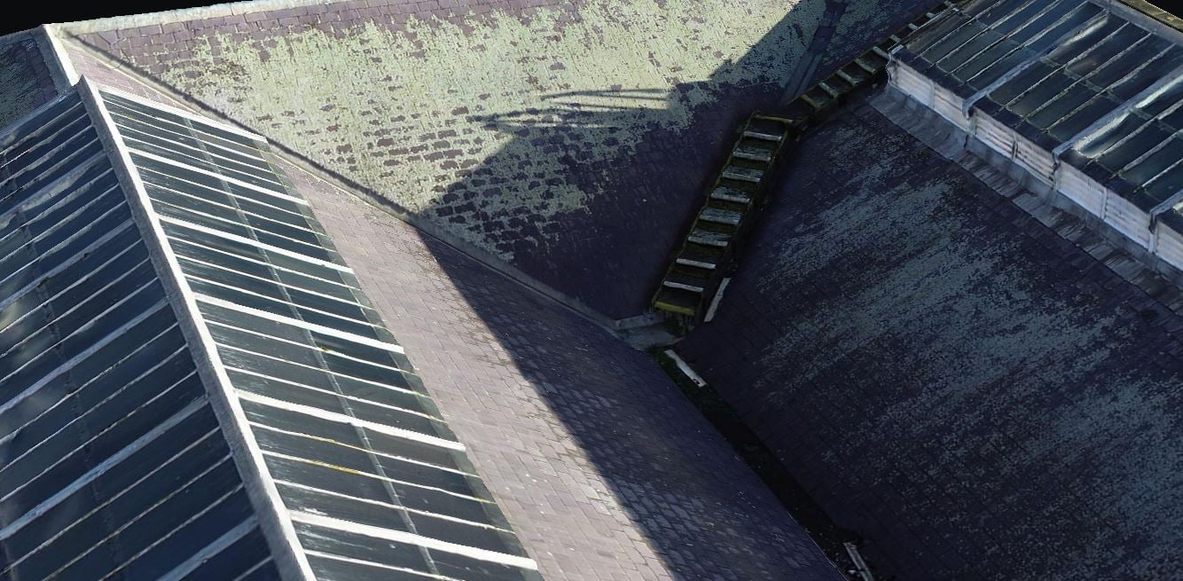
Roof 3D model As with all projects health and safety is a top priority. When it comes to surveys of structures especially a roof there are loads of protocols put …
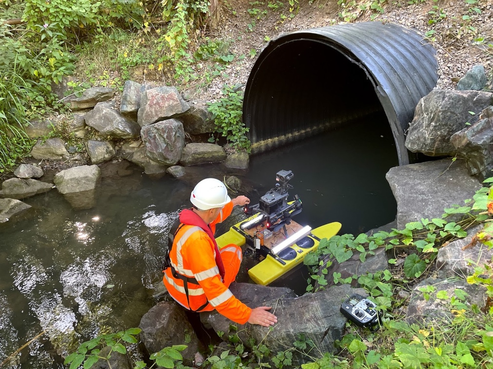
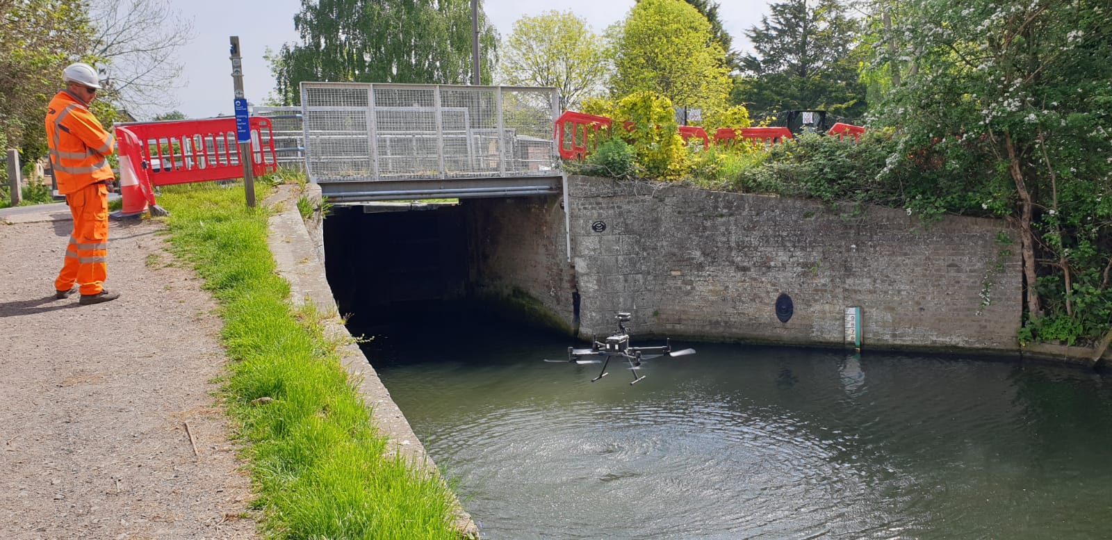
This is another area of survey work which is becoming popular for UAV surveys. Due to the nature of a culvert, there are a load of potential health and safety …
What is Lidar? Lidar is an acronym for “light detection and ranging.” This means using light waves (lasers) to collect data. The light pulses as they are called bounce of …
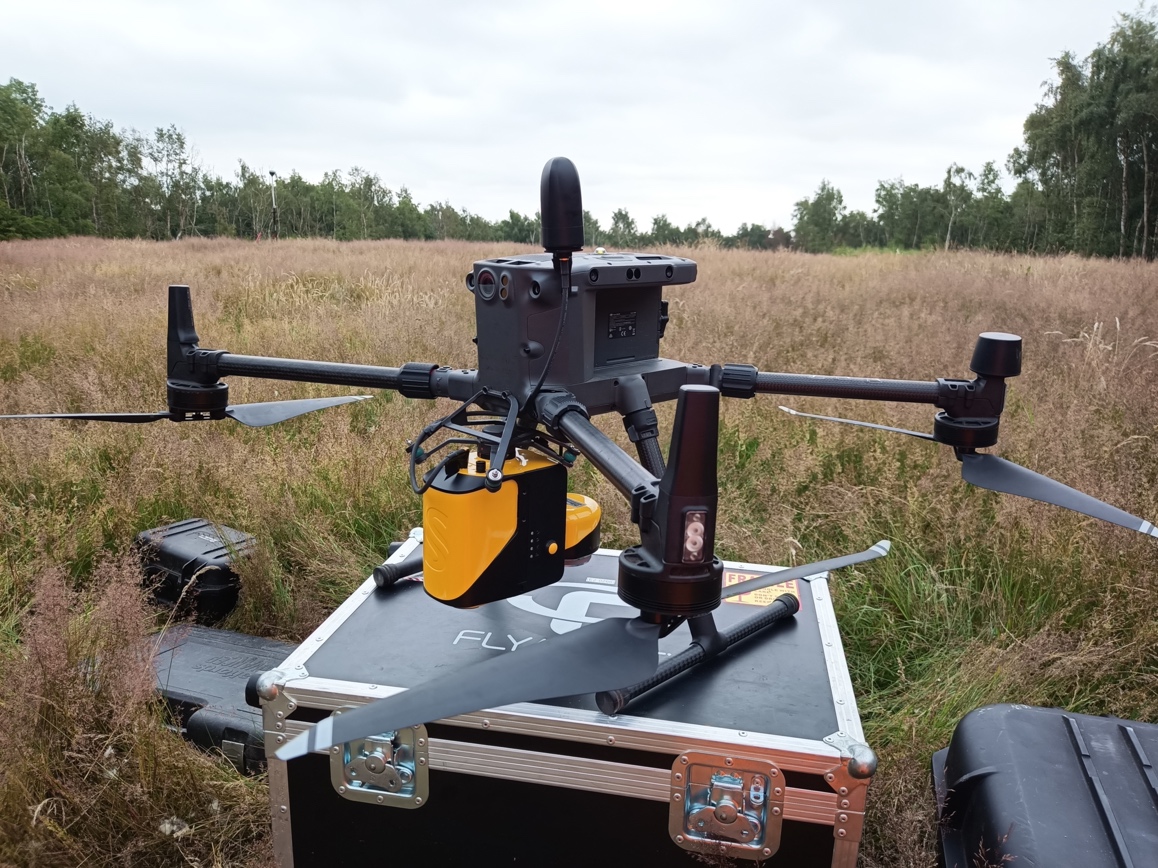
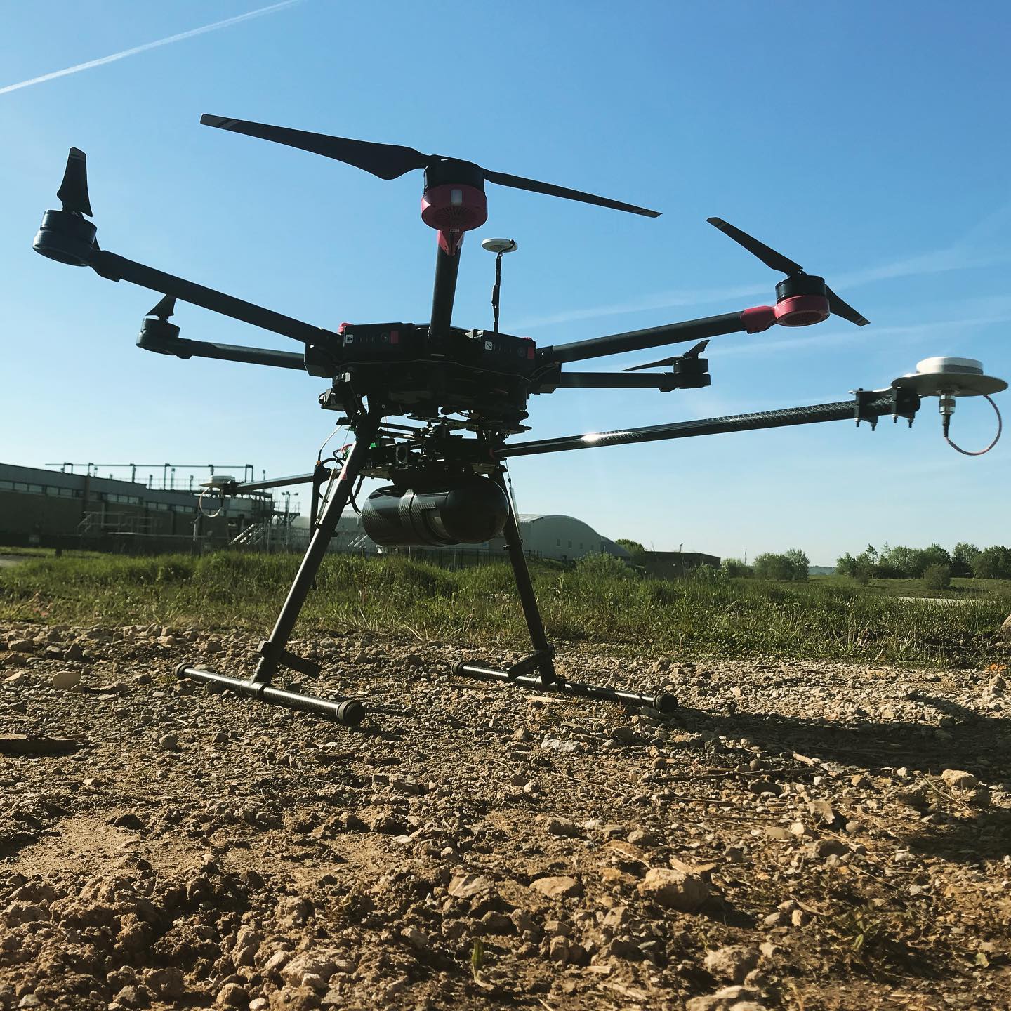
Photogrammetry is the process of collecting data that can be used to create a high-resolution 3D model or 3D map. There are various drones out there for the job, they …
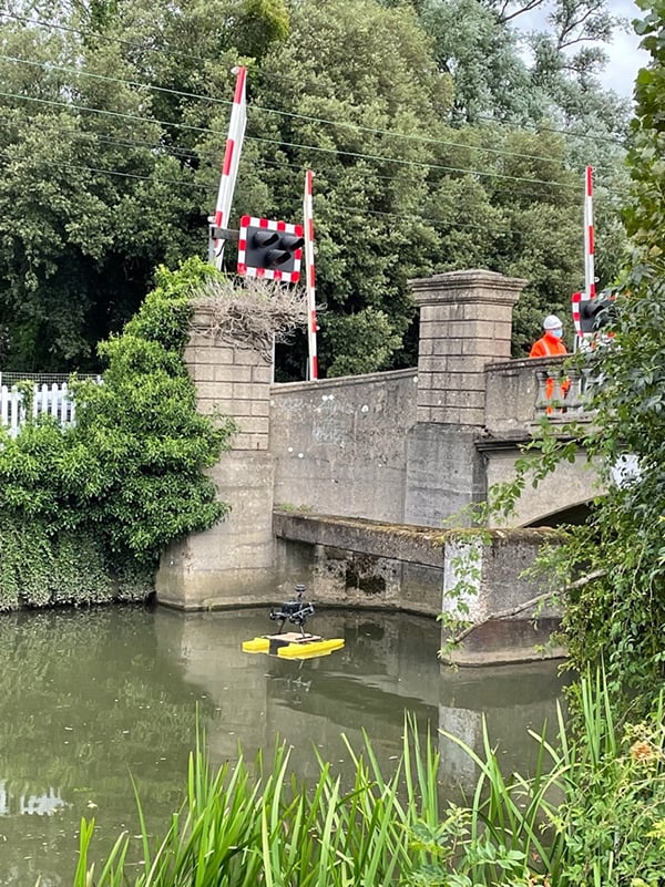
An Unmanned Surface Vehicle (USV) or Autonomous Surface Vehicles (ASV) are vessels that operate on the water surface without any crew on board, they are remotely operated by an operator …
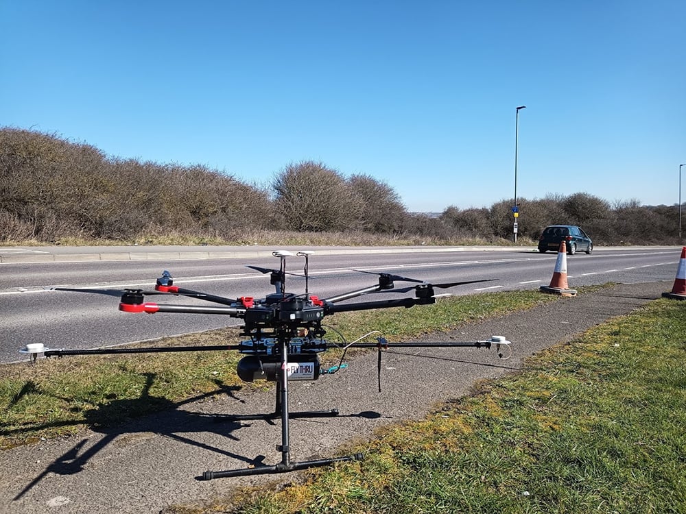
Construction drone inspection Construction projects and job sites vary which means that traditional survey methods cannot always be used. Thanks to advances in drone technology, drones can be applied to …
Drones are the perfect way to carry out infrastructure surveys, not just because they can be cost effective and quick but because they can deliver a range of different outputs. …
Inspecting bridges can be an expensive, time consuming and a dangerous activity. The traditional methods require multiple staff often with a range of different training requirements such as confines spaces …
The use of remote sensors especially drones has become the norm when working on the rail network of the UK and beyond. Drone technology has advanced to such a degree …
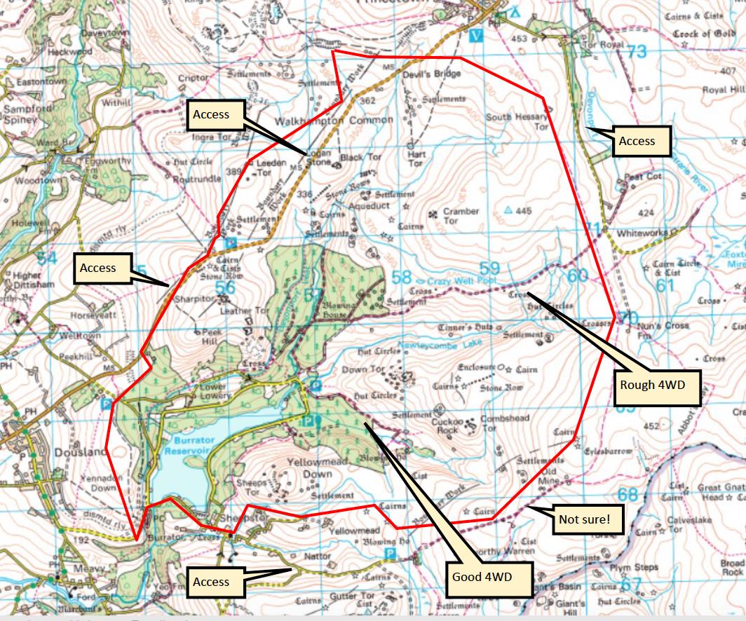
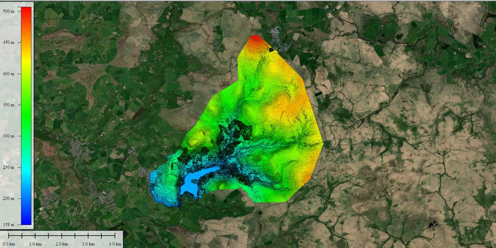
The Task The client in this case wanted to create a detailed aerial orthomosaic of an area of natural beauty bordering the Dartmoor National Park. Methods The only cost-effective way …