A UAV LiDAR and Photogrammetry survey of a former landfill in Warrington, Cheshire for Peel L&P
The Brief
Flythru were appointed by Geoterra on behalf of Peel L&P to carry out a UAV survey using both low level LiDAR and photogrammetry techniques on a former landfill site and adjacent land in Woolston Eyes, near Warrington, Cheshire.
The survey data was required by Peel L&P to enable them to generate a 3D model of the site and plan for the Butchers Field Extension toward to woodland East of the site.
The Solution
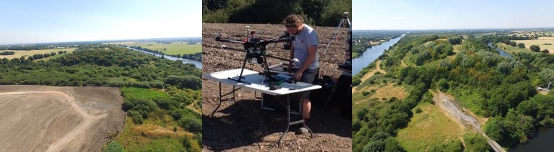
Geoterra experienced geospatial engineers in collaboration with our partners FlyThru in collaboration with Geoterra our experienced geospatial engineers utilised a bespoke heavy lift UAV equipped with a high definition DSLR camera and Routecene LiDAR sensor to fly over both the landfill site and adjacent land, generating a large multipath multi return laser scan point cloud. The point clouds were then post processed to produce an extracted ’bare earth’ Digital Terrain Model. Both sites were also flown with a DJI Phantom 4 UAV equipped with a high definition DSLR camera generating a series of photographs for the photogrammetry section of the survey.
Ground control points were set up across both sites and surveyed to OSGB OSTN15 National Grid.
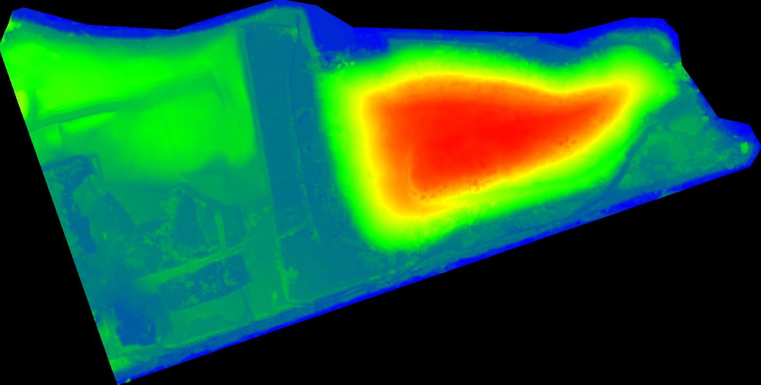
The Deliverables
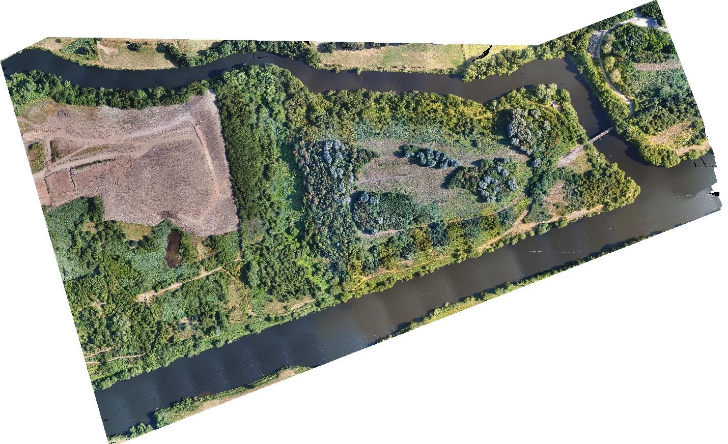
FlyThru provided the client with a range of key deliverables including a Digital Surface Model, Digital Elevation Model, Ortho-rectified mosaic photography and a 3D point cloud, plus an extracted bare ground DTM from a heavily vegetated DSM.