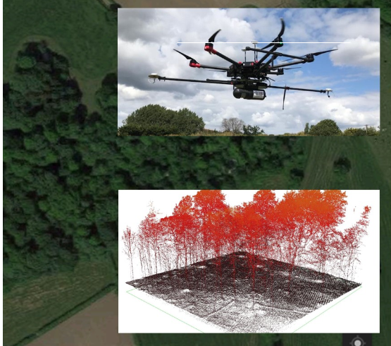
When surveys are required for terrain covered in vegetation, LiDAR produces detailed digital terrain models and 3D point clouds that could not be achieved using traditional surveying techniques or photogrammetry.
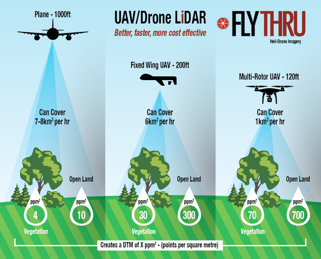
Whilst LiDAR systems have historically been outfitted to helicopters or mounted to vehicles, FlyThru have developed a revolutionary system allowing aerial LiDAR data to be captured using UAVs. This hugely reduces the cost of conducting LiDAR surveys and allows data capture to be undertaken in very remote locations. As UAVs enable the LiDAR to be operated more slowly and at lower altitudes, the data produced is 100 times denser and up to 10 times more accurate than systems carried by plane or helicopter.
Technical Information
AV LiDAR is an airborne version of terrestrial laser scanning, allowing for the rapid survey of large and complex areas. The system collects over 700,000 points per second with an average surface density of >700 points per square meter. Using data from a highly accurate on-board IMU to measure the altitude of the aircraft where each point is collected, as well as an on-board RTK GPS system, an extremely detailed 3D map can be created of any object or area. Post process correlation of IMU and GPS data can then geo-reference this data to an accuracy of just a few millimetres.
The accuracy of LiDAR makes it ideal for scenarios where terrain must be measured and monitored, especially in areas of dense vegetation, and for specialist projects such as powerline surveys for measuring line ‘sag’ and vegetation proximity.
READ LiDAR CASE STUDY