UAVs allow for surveying and mapping possibilities that are unachievable using full size aircraft or traditional surveying techniques. Our fleet of bespoke UAV platforms range from internal inspection drones that can fit in the palm of a hand to heavy lift platforms with a 6-foot wingspan, allowing data collection to be conducted in almost any environment.
Get in touch with us today to discuss your next project and get a free quote.
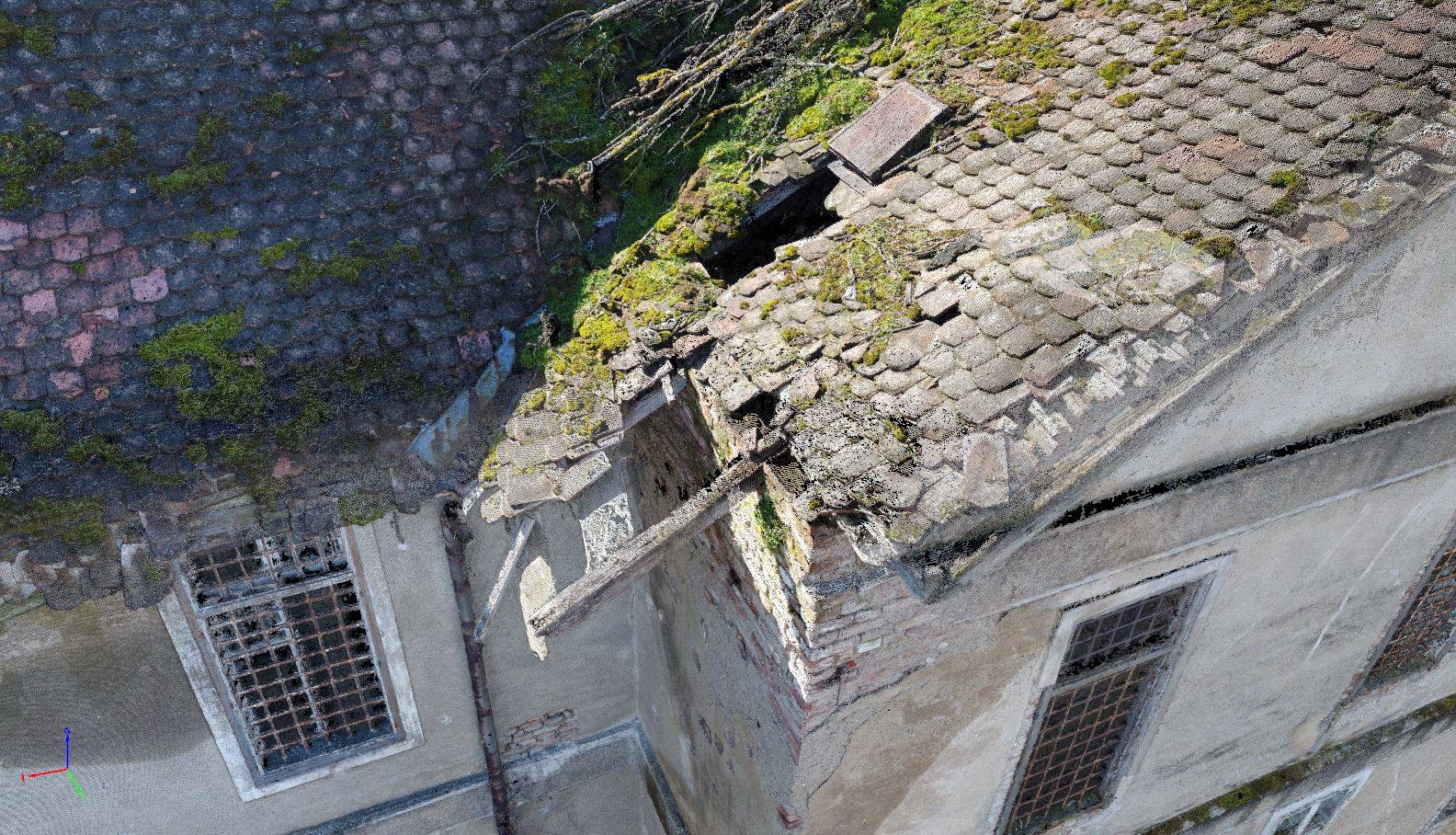
FlyThru utilises the latest modelling technology to create visually and dimensionally correct 3D models using aerial data. This service has many applications, including allowing inspections to be carried out on models rather than the infrastructure itself eliminating cost and risk from working from height, and by repeating topological surveys comparisons between models can be made, enabling land slippage or erosion to be monitored. Accurate dimensional measurements including volume checks on e.g. stockpiles can be calculated on the produced 3D models. Using photogrammetric techniques, we provide the following outputs from topological surveys:
- Point clouds, triangle meshes and photo-realistic models
- Spacial data analysis – measurements, area and volume calculations
- 3D animation fly-through
- Sub 20 mm accuracy
FlyThru has worked in a range of industries to provide clients with 3D topological surveys, including:
- Quarries / mining
- Construction
- Asset management
- Engineering inspection
To see FlyThru’s 3D modelling capabilities in more detail, please check out our 3D model case study.
3D MODELLING CASE STUDY