FlyThru’s UAV LiDAR system used to reconstruct the only WWII concentration camp on British soil.
The island of Alderney, a British crown dependency located 10 miles off the coast of France, was once home to a German concentration camp. The camp had been subject to many previous investigations following allegations of the existence of mass graves at this German SS prisoner of war camp. Professor of Conflict Archaeology and Genocide Investigation at Staffordshire University in the UK, Caroline Sturdy Colls travelled with the FlyThru team to the island to investigate the site based upon detailed evidence she and her team had collated.
The investigation and the surprising results were the subject of a documentary ‘Adolf Island’ produced by the Smithsonian Channel. The documentary showcased Flythu’s 3D mapping technology and demonstrated how LiDAR is currently being used in industries such as archaeology, forensics and construction to create a bare earth model to identify structures without disturbing or obstructing protected land.
Speedy data processing
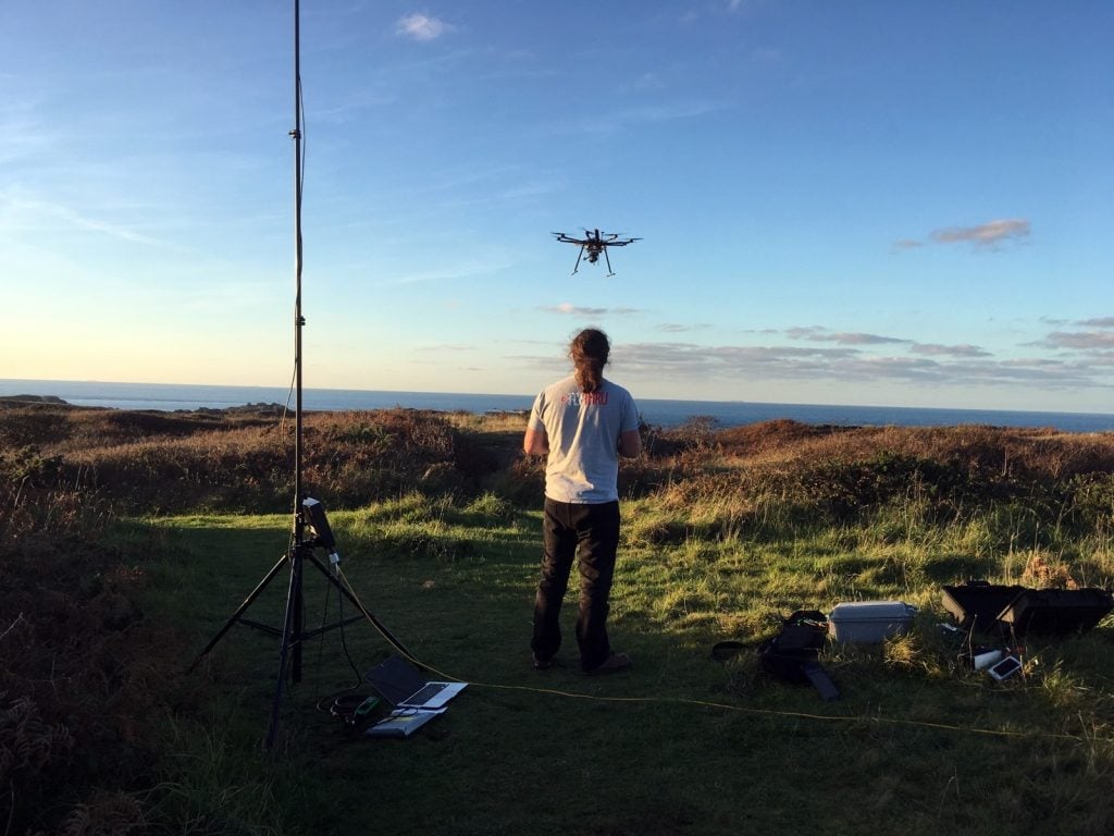
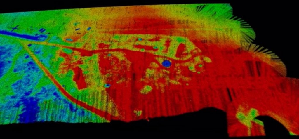
The data gathered was processed on-site immediately after the UAV survey using our bespoke 3D processing and visualisation software. Using the Bare Earth Tool within software we quickly and easily removed all the non-ground points to reveal the surface below and produce a Digital Terrain Model (DTM). The DTM exposed previously undiscovered features that had been completely obscured by the vegetation covering the site for decades.
Utilising different survey techniques
In addition to using UAV LiDAR we used photogrammetry, a different remote sensing technique in which hundreds (sometimes thousands) of photographs are taken of a site and stitched together to create an overall three-dimensional model. In this case we used our PPK fixed wing Twin Mapper system carrying a 42Mp camera. The two datasets were combined to give a full picture of the areas of interest in 3D as seen in the trailer for the documentary https://www.smithsonianchannel.com/videos/investigating-evidence-of-nazi-atrocities-on-british-soil/67687
In Summary
FlyThru have been using UAV LiDAR systems for over 4 years now in circumstances where our clients need to penetrate vegetation it has proved to be a valuable tool, some customers even describing the data as “ground breaking”. The number of laser hits we achieve on the ground is unparalleled with up to 400pts/m2 through thick vegetation unachievable using conventional manned aviation. Our equipment is ideal to survey sites which are overgrown, woods and forests and areas that need not be disturbed or are physically inaccessible preventing conventional survey methods. Due to the thick cover of vegetation on the site in Alderney it would not have been possible to visually detected the structures we found and conventional survey techniques would have been intrusive and potentially spoiled this rare archaeological site. With the LiDAR system on the UAV and detailed data analysis we were able to achieve results in a fraction of the time conventional survey methods would have taken.
Client Testimonial
Professor Sturdy Colls said, “The LiDAR and photogrammetry UAV surveys that FlyThru completed on Alderney assisted us greatly in our research. The overgrown vegetation and the size of the sites that we were investigating made ground-based surveys difficult and using UAV was the obvious choice. FlyThru were knowledgeable, competent and friendly and explained every step in the process. Health and safety and securing permissions were at the forefront of their approach. The results were better than we could have hoped for. At SS concentration Camp Sylt many additional structural elements were identified in the LiDAR survey that were previously hidden behind dense vegetation. This allowed us to complete, for the first time, a digital reconstruction of this important site“.