UAVs allow for surveying and mapping possibilities that are unachievable using full size aircraft or traditional surveying techniques. Our fleet of bespoke UAV platforms range from internal inspection drones that can fit in the palm of a hand to heavy lift platforms with a 6-foot wingspan, allowing data collection to be conducted in almost any environment.
Get in touch with us today to discuss your next project and get a free quote.
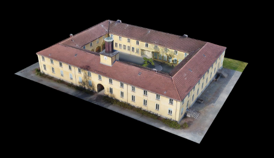
FlyThru work closely with strategic partners including experts in land surveying and geospatial engineering. Together, we use our combined knowledge and experience to offer our clients boundary pushing solutions in any situation where aerial survey data is required. Offering both 2D mapping and 3D topological surveys, and with a range of drones designed to allow for surveying of any scale, FlyThru services cater for clients in all engineering sectors. For a look at FlyThru’s 3D modelling capabilities in greater detail, please see the 3D modelling case study.
3D MODELLING CASE STUDY