FlyThru do not only offer drone based solutions, naturally drone solutions work alongside other new and existing technologies. As part of our ongoing development we are now able to offer a whole range of specialist services to work alongside our drone solutions. This has been made available through internal development and training and strategic partnerships.
FlyThru pride ourselves is offering a coordinated client focused service, ensuring the client receives the best possible data. As part of this approach we can offer the following services:
- Topographical Surveys
- GPR
- Leak Detection
- Deformation Monitoring
- 3D Laser Scanning
- CCTV Surveys
- Confined Space Surveys
- PAS128 Utility Surveys
- Bathymetric/Hydrographic Surveys
- GIS Asset Mapping
- 3D CAD Modelling
- Silt Surveys
Using conventional echo sounders the topography of the submerged invert of a reservoir can be measured in precise detail or, when deployed in combination with a parametric sub-bottom profile, the strata below the invert can be interrogated allowing buried structures such as intakes or pipelines to be located. Using the sub-surface profile data we can calculate the relationship between volume of storage at any depth of water to provide a means of monitoring water reserves and the rates of infill and extraction. Understanding the availability of water at all depths provides valuable data that can be used in combination with water quality stratification information to determine the optimum depth from which water can be extracted, its quantity and thus enables a robust water management regime to be established, reviewed and adjusted as parameters change.
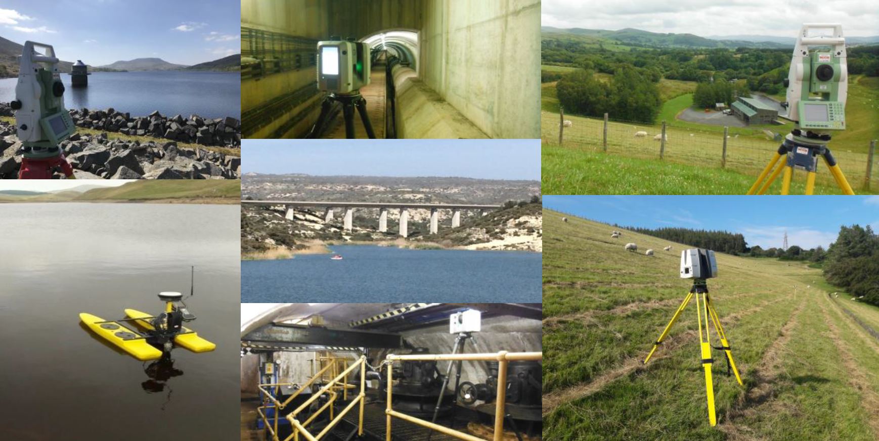
Reservoir Deformation Monitoring
All dams will be liable to some degree of movement over time and it is important to monitor that deflection to ensure it doesn’t introduce serious issues. Movement may occur because of the nature of how the dam was constructed, the geology and ground conditions beneath the dam. Using precision surveying techniques we can install permanent fixed monitoring stations and perform repeat surveys to determine movement and assess any unusual deformation.
3D Laser Scanning
3D HDS Laser Scanning can provide a cost effective solution to gathering data of incredible detail in a simple process. Using the latest portable laser scanning technology it is possible to capture precision point cloud data integrated with high definition imagery of every aspect of a dam, valves, pipework and other associated mechanical and electrical installations as a comprehensively detailed asset record. The dataset can be used for interpretation of precise dimensions, as a basis for design or replacement of components, as a digital terrain model and for monitoring condition or deformation. Output files can be in the form of 2D or 3D CAD drawings, 3D Mesh and Surface files, colourised point cloud data and BIM compatible 3D Revit models. 3D as built models provide an accurate and detailed visualisation of the structure where an asset inventory can be established for future use. All data can be geo-referenced to local or national datum to correlate with other digital data sets.
Ground Penetrating Radar
Traditional GPR with topo survey of buried services, primarily for the water companies in relation to them looking to install new buried apparatus. We have our own DS2000 to perform these surveys.
Alongside this we can offer UAV GPR, a service very much in its infancy but already showing its self to be invaluable in many situations, for instance – the search for un-exploded ordinance.